Sunday drive


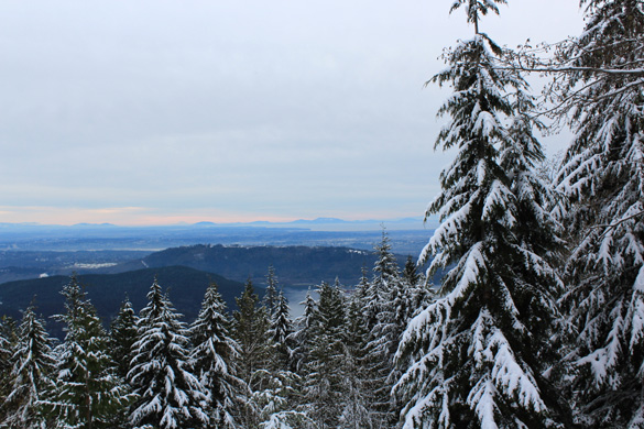
Escaping the three-girl-band practice coming to our house this afternoon, we went on a drive up to one of our local mountains to see the snow. A short-lived snowfall down here near sea level this past Thursday night had left us hankering for the sight of more. Unlike the other North Shore mountains, Mt. Seymour does not yet have their downhill skiing open so we knew it would not be too busy.
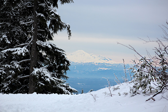
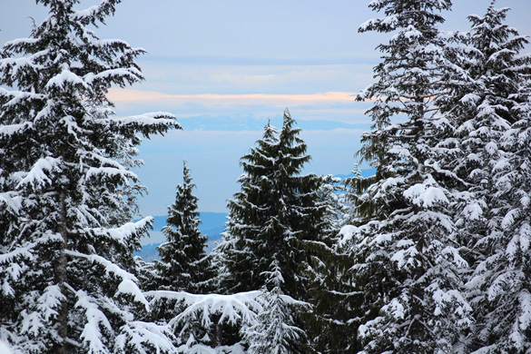
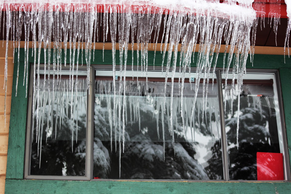
Our favourite sights are the massive snow-covered evergreen trees, so magical and beautiful on the drive up and on top, and the amazing long-distance views over the city and valley, with Mt. Baker in Washington state to the southeast and Vancouver Island to the west. We love the clean white snow up there and the icicles on the buildings were a bonus sight. But, oh, was it cold! Our thermos of hot mocha was a good idea.
(We might get a dump of snow here tonight, warns the weatherman…)
November 20, 2011 in Canada and BC, Home by Marja-Leena
Marja-Leena,
I’m in my usual state of confusion (part of it being that I have to soon walk to be tortured – in the dentist chair!) but forgive me if I have asked it before: are Vancouver B.C. mountains Rockies or Cascades? Or neither of them?
I have driven past Vancouver long time ago, and I can’t remember the details anymore, except that near Vancouver I imagine we passed Rockies high, on Columbia-icesheet area, and saw mounting sheep. Tasted the water coming of from the icesheet and it tasted strong like some odd minerals.
Little more down Alpine meadows and I felt very light headed, weighed very little and thought I am the first woman on the moon. Jumped from flower to flower until I felt truly dizzy and started bleeding on the nose.
We had frost on the ground last night, now it’s wet and +5 C.
instant homesickness! i’m busy putting winter layers on the house but we’re still at 15 degrees this afternoon! those icicles are fantastic. x
Ripsa, BC has many mountain ranges. By Vancouver are the Coast Mountains running north along the coast. The Cascades are mostly in Washington state in the US but the northern part does extend a little into Canada along the south edge of the Fraser Valley. Mt. Baker sits there on the US side but is very visible from most areas in southwest BC.
The Columbia Icefield which you mention is in Jasper National Park within the Canadian Rockies which run along eastern BC. I remember well those mountain sheep, wildflowers and dizzying heights. Since you asked about our mountains before, you might find this simple map helpful, as well as this article, sorry I could not find it in Finnish.
I have read how warm Finland still is. Winter is late there. (Hope the dentist visit wasn’t too painful!)
Elisa, yes, I imagine so, for you love these mountains too. Wintry weather has been at least two weeks earlier than normal here. The mountains have lots of snow. Down here we’ve had some frosts but only a wee bit of wet snow. That snowfall warning lost out to a warm front with just rain/snow coming down this morning. At higher elevations it’s probably snowing.
I always loved the west coast mountain ranges whether driving through them, hiking, or flying over. The shapes are magnificent from the sky. It’s funny that I saw Mt. Baker most often when I lived in BC and rode the ferry regularly to Vancouver Island. Seeing it always took my breath away. Climbing it wasn’t in my repertoire.
Your photos of the snowy landscape are very nice indeed.
Susan, Mt. Baker is certainly an iconic view from many directions. Your mention of flying over the mountains reminded me how stunned I’d always be to see how vast is the snow capped mountain range behind these North Shore mountains. Some people don’t realize that because it’s close to the city. It’s a wildnerness beyond and too many get lost and sometimes die. I’m not a climber either though I’ve done some skiing in my younger days – it’s too steep for me on cross-country skiis.
Lovely near monochromes. Why was there a three girl band practice at your house?
Just wonderful. Our mountains are frosted as well. Should go for a drive up a canyon this weekend.
Lucy, our youngest and her two friends/colleagues were practicing for their annual Christmas party coming up at work. Sounds good but just too loud in our living room….
Zhoen, yes, you should! There is still so much more snow coming – when it rains down here, it snows up there this time of year. I must get some warmer winter clothing so I can go up there more often, it’s so beautiful and not far to go.
Marja-Leena,
thanks a lot for the map! The area is geologically so complicated that no wonder I haven’t understood it. I will save this photo in it’s own place and look at it whenever you are some parts over there, nearby Vancouver B.C.
We do have a National Geographic map of North America, but it doesn’t show details.
You must have earthquakes with that kinda formations…Do you?
Ripsa, you are welcome! BC certainly is a geographically varied province with many mountain ranges, valleys, even desert regions. Yes, the west coast is earthquake prone, being near a fault line that runs all along the Pacific from South America to Alaska over to the Asian side. We’ve had mild tremors but no damage, yet, but they say we could be due for a major one.
Love those views–I have only seen Vancouver and the area in the summer… And that final picture would make a splendid Christmas card, wouldn’t it–not a bit saccharine, with lovely reflections and colors.
Marly, yes, the last would be a great Christmas card. I’ve already started on them so maybe next year.
Should have known that you did marvelous Christmas cards!
Marly, well, I hope folks think they are marvelous. I will, as always, be posting my card online for all my blog friends and readers closer to that big day. I’m almost finished printing them, then there are all the letters to write. I’m not as late as usual this year, so far….